top of page


It's likely happened at least once when we leave the island to travel downtown, or to Mt. Pleasant. There we are, making good progress along Maybank Highway toward Folly Road when....the bridge is up. Full stop.

The Wappoo Creek Bridge (formally, the Burnet R. Maybank Bridge) is one of only two remaining movable bridges in greater Charleston, the other being the Ashley River Bridge that carries Savannah Highway over the river. Both are drawbridges dating in their present incarnation from the mid-1950's, although Wappoo Creek's is actually the third bridge to cross what is sometimes called Wappoo Cut, a tributary of the Stono River now part of the Intracoastal Waterway. So while we're stalled at the bridge, we can wile away the time by contemplating the history around us.


We're sitting on what was once part of the McLeod Plantation, which stretched along what is now Folly Road to Harborview Road, along Maybank Highway to the Stono River, and whose more than eight hundred acres now lie under the shopping malls and fast food restaurants of this eastern end of James Island. (A small portion including the McLeod family home survives and is managed by Charleston County Parks as an historic site.) Nineteenth-century travelers between James Island and St. Andrews Parish (what we now call West Ashley) had to cross the creek by steamboat at the McLeod's landing, where the family opened a store selling provisions and dry goods. Even earlier, in the eighteenth century, Eliza Lucas famously began cultivating indigo along the banks of the creek, the first to do so in colonial America.

The first bridge across the Wappoo, c.1903

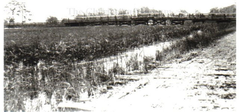
The first permanent wood-trestle bridge was built in 1899 at the landing, west of the present bridge; a second span replaced it just after the First World War, when West Ashley's development had begun and the Charleston Country Club bought 200 acres of the McLeod property for its golf course. Today's bridge was sited to the east to align it with state road 171/Folly Road.


The drawbridge, with its thirty-three-foot center clearance, is an "on demand" bridge, required to open on request from boaters traveling between Charleston Harbor and Wappoo Cut and the Intracoastal. On weekdays, when a request is received, it will open on the half-hour between 9am and 4pm on weekdays, until 7pm on weekends. Despite the frequent traffic backups and grousing from motorists, there have been no publicly revealed plans to replace the bridge. Depending on the amount of waterborne traffic, the opening and closing process can take fifteen minutes or more, so rely on patience and a sense of history to pass the time.


With the expanding construction of new planned developments on Johns Island - a proposed new 120-home golf community on more than 900-acres between Bohicket and River Roads and the proposed expansion of Freshfields Village, among many others - neighborhood groups are becoming more vocal on (among other issues) water usage. Although we may be surrounded by water, where does what flows out of your tap come from, and how much demand can be met?


The quick answer for Seabrook Island's water source, of course, is our island's Utility Commission which oversees the maintenance of our water and sewer lines. But our drinking water comes from off-island, piped in from St. Johns Water which supplies all of Johns Island; and St Johns Water, in turn, gets its water from the county-owned Charleston Water System. So where does CWS' water come from?


Charleston's only remaining aquifer pump

Providing potable water to a rapidly growing city has been a concern since the city's founding in the 17th-century, when water from creeks and rivers was collected in holding tanks for general use. By the 19th century, after the bacterial basis of cholera and diphtheria epidemics were understood and had been traced to contaminated communal water sources, Charleston undertook geologic surveys to locate underground sources of fresh water, the first of which was an aquifer located under Marion Square. (The last remaining downtown aquifer pump still stands downtown, although long disconnected.) By the turn of the 20th century, the city's explorations had ventured further inland to discover deep aquifers held in ancient geologic layers near Goose Creek and Hanahan; and by 1917, CWS was supplying clean water from protected watersheds fed by these aquifers and from the Edisto River, collected in reservoirs, piped to treatment plants and, eventually, to us.


One of Seabrook's three holding tanks

Although water demand on Seabrook remains well below available supply according to the SIUC, our island/s water supply is still impacted by growing demand elsewhere. The planned developments noted above on Johns Island would all draw water from St. Johns Water. Meanwhile, the South Carolina DNR reports that parts of the state, including coastal areas, have been gradually sinking, partly due to reductions in water table levels.While we may take water for granted, sustainable growth is key to protecting this most critical foundation of island life.


We may hardly notice them because they're so always present, including on the town of Seabrook Island's official seal, but brown pelicans, with their seven-foot wingspans and silent gliding formations, are a key indicator species of the health of our surrounding waters. Feeding on sardines, anchovies, herring, mullets, minnows and small crustaceans, a thriving colony means a sustainable marine ecology.


Brown pelicans (Pelecanus occidentalis carolinensis) are one of three species of pelicans found in the Americas (the Peruvian and American White are the other two), and are common from southern New England as far south as the mouth of the Amazon River. Listed as endangered until 2009 due to low birth rates caused by exposure to DDT and other toxic pesticides, populations of "brownies" have stabilized, as a visit to the Deveaux Bank, a major breeding ground at the mouth of the North Edisto River, will confirm.


Breeding takes place during March and April, when you'll see a yellow patch on the birds' white heads while in breeding plumage. Males and females alternately tend to a clutch of three or four eggs, keeping them warm under their webbed feet until they hatch in about thirty days. Pelicans are among the longer-lived marine species with a lifespan of up to thirty years.


Soaring as high as seventy feet above the water while searching for fish, brown pelicans are one of only two of the world's eight species to feed by diving, plunging headfirst into the water to scoop up their prey before surfacing and straining the water from their signature pouch to swallow their catch.


Brownies are non-migratory, so we're able to enjoy these magnificent birds all year round as they soar gracefully overhead or skim offshore waters.


All Content Copyright 2026 Seabrook Island Natural History Group

PMB 612, 130 Gardener’s Circle, Johns Island, SC 29455

bottom of page